Heritage Walk: Along the Diamond Creek – 7 July, 2018

Saturday, 7th July, 2018 at 2.00pm – Please note this excursion is CANCELLED due to bad weather. To be rescheduled at a later date.

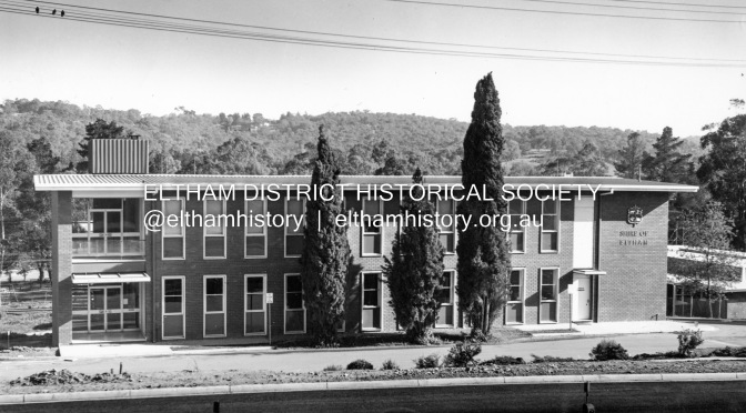
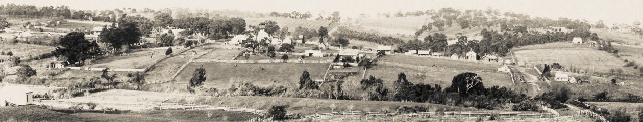
The Diamond Creek is a major feature of the open space spine that runs through the centre of Eltham. From the time of the first European settlement of the area most of the land along the creek valley was private property extending to the centre of the creek. Over many years land has been purchased by the Council and the State Government to create a continuous open space system along at least one side of the creek, from central Eltham to the Yarra River. The area contains many places of historic interest.

Fabbro’s original home when they first moved to Eltham in Ely Street, c.1992 (from the collection of Eltham District Historical Society)

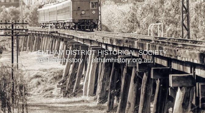
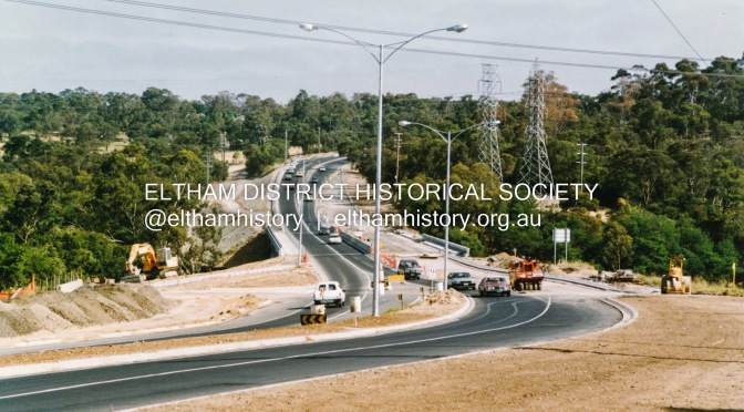
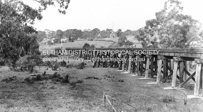
Our July excursion will comprise a walk along the creek path from central Eltham to Fabbro fields finishing at Ely Street. This is about 2 km one way and should take about 2 hours including plenty of time to stop and talk. There will be a return walk without much commentary but those who wish to can catch a bus back from the corner of Main Road and Dalton Street. A particular point of discussion along the way will be the historic railway trestle bridge as to its history and its future given the proposal to duplicate this section of the railway.

This walk on Saturday 7th July will start at 2pm near the scout hall at the southern end of Youth Road (Melway ref 21 J 5).

This excursion is free and is open to the general public as well as Society members.

Please note that dogs are not permitted on Society excursions.

The phone number for contact on the day is 0409 021 063.

June Meeting – History of the former Shire of Eltham Office site

Eltham District Historical Society Meeting

Wednesday, 13th June 2018 at 8pm

Eltham Senior Citizens’ Centre, Library Place, Eltham

Eltham Shire Office, 895 Main Road, Eltham, 1968 (Shire of Eltham Pioneers Photograph Collection #657 held jointly by Eltham District Historical Society and Yarra Plenty Regional Library)

Prior to Shillinglaw Cottage (c.1878-80) being relocated to where it is now operated as a popular cafe near the Eltham Library, it was within Josiah Holloway’s 1850s subdivision known as Little Eltham, which later became the centre of the first Eltham township. Originally a farmer’s cottage it is historically significant because it is one of the Shire’s oldest dwellings and a fine example of the work of the well-known pioneer builder George Stebbing.

In 1964 the then Shire of Eltham purchased the Shillinglaw property with the intention of demolishing the cottage and constructing new Shire offices on the site. However extensive community action resulted in funds being raised to have the building saved and relocated further south to the Eltham Common, where it was joined by the Eltham Library in 1994.

The new Shire offices opened in 1965, but following municipal restructure in 1994 these were demolished in 1996 and the land sold to a developer, which precipitated a dramatic trail of community angst, threats of legal action, the sacking of a newly elected council and several unsuccessful development proposals, by subsequent councils.

After all these years the vacant site there is still guarded by the three trees that were outside the front of the Shillinglaw Cottage.

At our Society meeting on Wednesday, 13th June, 2018, Jim Connor will speak about the dramatic tale encompassing the history of the former Eltham Shire office site and the adjoining War Memorial Buildings complex, which are now being considered for sale or redevelopment by the current Nillumbik Shire Council.

As always, Society members and visitors are most welcome to attend this meeting at 8.00pm on Wednesday 13th June, in the Eltham Senior Citizens’ Centre, Library Place, Eltham.

Past, Present, Future: Where is the balance?

by Jim Connor

Eltham Trestle Bridge, 1981. The Shire of Eltham Office is in background; constructed 1964, opened 1965. (Photo: G.L. Coop, Eltham. From the collection of Eltham District Historical Society)

An ongoing challenge as members of a historical society is how do we balance the pressures of possible future development against our desires to protect and honour our valued past, our local history.

As a historical society representing the interests of our community we strive to remain steadfastly non political, yet at times get caught between individual political positions.

Three current local ‘hot’ topics of historical significance are the Eltham Trestle Bridge, the Eltham Avenue of Honour/Eltham Gateway and the former Eltham Shire offices site and adjacent
War Memorial buildings complex.

The Eltham District Historical Society has clearly stated that the valued trestle bridge is of local historical significance, should remain as is and should not be compromised, if and when the railway line is duplicated between Greensborough and Eltham. The sitting State member has indicated it can remain as is and there will be improved scheduling, with no advantage to be gained with duplicating the bridge. Despite claiming ‘the trestle bridge remains’ the political opponent has stated in a meeting with EDHS that, if elected, a new bridge will be constructed beside it and that his position is ‘not negotiable’.

Similarly, possible duplication of Main Road through the Eltham Gateway and World War 1 Avenue of Honour is being considered, which we believe would totally destroy the historical and cultural significance of this meandering, tree enhanced entrance to Eltham.

What are the options, what is the cost vs benefit? Should we need to compromise our heritage even further to possibly save a couple of minutes in travel?

The third topic is that Nillumbik Shire Council is currently considering redevelopment of the former Eltham Shire offices site in Main Road, Eltham, which includes the Shillinglaw trees, together with the adjacent War Memorial buildings complex.

What do we value of our past to preserve in the present for the ‘future’, do we restrict our creative options by honouring our heritage, where is the balance?

These are decisions we will all need to consider……sooner rather than later.

[Reproduced from Eltham District Historical Society Newsletter No. 240, June 2018]

ThrowbackThursday: Junction of Sherbourne, Para and Simms Roads, Briar Hill, 1967

Preliminary construction work for the re-alignment of the Para Road, Simms Road and Sherbourne Road intersection prior to the replacement of the Sherbourne Road railway overpass bridge at Briar Hill, 3 November, 1967. Viewed from the western side of Para Road adjacent to Graham Body Works. (Photo: Photostitch from multiple images on a roll of 35mm black and white negative film; from the collection of Eltham District Historical Society).

#ThrowbackThursday – Today we time travel back to November 3, 1967 to the intersection of Para Road and Sherbourne Road, Briar Hill; or is it? In fact, Sherbourne Road still ends at the railway overpass, in a T-intersection with Para Road and Simms Road is a T-intersection off Para Road a few yards down from the railway bridge. On the corner of Simms Road and Para Road is an older house, which belongs to Mrs Cameron. Her daughter married a man named Davey after whom Davey Street is named. But there is a bulldozer at work and a large section of land is being cleared and levelled. Work is under way to commence the realignment of Para Road and Sherbourne Road in preparation of a new railway overpass. The access to Simms Road will change significantly and Mrs Cameron’s house has its days numbered as it is about to become the site of the new Montmorency Secondary College, which will open in 1969. Where the two cars are parked is where the roundabout intersection is sited today.

Preliminary construction work for the re-alignment of the Para Road, Simms Road and Sherbourne Road intersection prior to the replacement of the Sherbourne Road railway overpass bridge at Briar Hill, 3 November, 1967. Viewed from the western side of Para Road adjacent to Graham Body Works. (Photo: Photostitch from multiple images on a roll of 35mm black and white negative film; from the collection of Eltham District Historical Society).
Preliminary construction work for the re-alignment of the Para Road, Simms Road and Sherbourne Road intersection prior to the replacement of the Sherbourne Road railway overpass bridge at Briar Hill, 3 November, 1967. Viewed from the eastern side of Para Road opposite Graham Body Works. (Photo: Photostitch from multiple images on a roll of 35mm black and white negative film; from the collection of Eltham District Historical Society).
Preliminary construction work for the re-alignment of the Para Road, Simms Road and Sherbourne Road intersection prior to the replacement of the Sherbourne Road railway overpass bridge at Briar Hill, 3 November, 1967. Viewed from the railway line opposite Graham Body Works. (Photo: Photostitch from multiple images on a roll of 35mm black and white negative film; from the collection of Eltham District Historical Society).

ThrowbackThursday: Eltham Railway Station, 1983

A single carriage Tait train from Hurstbridge about to arrive at Eltham Railway Station at Platform 1; a Hitachi electric train waits at Platform 2 to depart for Flinders Street, 1983. (Photo: EDHS, digital photo-stitch of two separate photos from the collection of Eltham District Historical Society “Fred Mitchell Collection”, donated by Fred Mitchell)

#ThrowbackThursday – Today we time travel back to 1983 and Eltham Railway Station. A single carriage ‘Red Rattler’ Tait train from Hurstbridge is about to arrive at Platform 1 where it will shortly depart again for Hurstbridge. A Hitachi electric train sits at Platform 2 awaiting departure for Flinders Street. The last of the Tait trains were withdrawn from service in December 1984.

A Hitachi electric train waits at Eltham Railway Station Platform 2 to depart for Flinders Street, 1983. (Photo: ©Fred Mithchell; from the collection of Eltham District Historical Society “Fred Mitchell Collection”, donated by Fred Mitchell)
A single carriage Tait train from Hurstbridge about to arrive at Eltham Railway Station at Platform 1; a Hitachi electric train waits at Platform 2 to depart for Flinders Street, 1983. (Photo: ©Fred Mithchell; from the collection of Eltham District Historical Society “Fred Mitchell Collection”, donated by Fred Mitchell)
A single carriage Tait train at Eltham Railway Station at Platform 1 waiting to depart for Hurstbridge; a Hitachi electric train waits at Platform 2 to depart for Flinders Street, 1983. (Photo: ©Fred Mithchell; from the collection of Eltham District Historical Society “Fred Mitchell Collection”, donated by Fred Mitchell)
Toot! Toot! The single carriage Tait train departs for Hurstbridge from Eltham Railway Station Platform 1, 1983. (Photo: ©Fred Mithchell; from the collection of Eltham District Historical Society “Fred Mitchell Collection”, donated by Fred Mitchell)
Single carriage Tait train departing for Hurstbridge form Eltham Railway Station Platform 1, 1983. (Photo: ©Fred Mithchell; from the collection of Eltham District Historical Society “Fred Mitchell Collection”, donated by Fred Mitchell)

Author: P. Pidgeon, May 2018

ThrowbackThursday: Fitzsimons Lane Bridge Duplication, 1991

#ThrowbackThursday – Roadworks, what a pain, and there seem to be so many going on lately. In reality the short term pain brings long term gain. After all, imagine what Fitzsimons Lane Bridge would be like today if it was still only a single lane each way. So today we time travel back 27 years to July 1991 where we can see work in progress, craning the final steel and concrete section into position to connect the Templestowe and Eltham ends of the duplicated bridge.

Originally Fitzsimons Lane was the name of the road on the Templestowe side of the Yarra River; on the Eltham side it was known as the Eltham-Templestowe Road. The road is divided on the Templestowe side but not on the Eltham side. When the new bridge was built c.1966, the divided road was not continued in the Shire of Eltham as it would have required a significant widening of the cutting.

Installation of the final section to join the two ends of the duplication of Fitzsimons Lane Bridge, 6 July 1991. (From the collection of Eltham District Historical Society)

Installation of the final section to join the two ends of the duplication of Fitzsimons Lane Bridge, 6 July 1991. (From the collection of Eltham District Historical Society)

Installation of the final section to join the two ends of the duplication of Fitzsimons Lane Bridge, 6 July 1991. (From the collection of Eltham District Historical Society)

Installation of the final section to join the two ends of the duplication of Fitzsimons Lane Bridge, 6 July 1991. (From the collection of Eltham District Historical Society)

Bridgeworks on Fitzsimons Lane across Yarra River, Eltham, 1991. The new lanes are now in place and final works are in progress. (From the collection of Eltham District Historical Society)

Looking north across the Fitzsimons Lane Bridge over Yarra River between Eltham and Templestowe, c.1985. Turnoff to Candlebark Park on right. It can be seen that the road on the Eltham side has now been widened to two lanes each way, merging to a single lane to cross the bridge. (From the collection of Eltham District Historical Society)

Looking north across the newly constructed Fitzsimons Lane Bridge over the Yarra River between Eltham and Templestowe, c.1966. It can be seen that the road on the Eltham side is only a single lane. (Polaroid photo from the collection of Eltham District Historical Society)

ThrowbackThursday: Roadworks, Bridge Street and Main Road, Eltham, 1968

#ThrowbackThursday – Today we time travel back to 1968 and the intersection of Bridge Street and Main Road. Roadworks are well under way for the widening of Main Road from Pitt Street to Elsa Court. Extensive works were being undertaken to revise the intersection of Bridge Street. As a consequence, traffic delays were an everyday occurrence.

Excavating at the corner of Main Road and Bridge Street, Eltham, 1968; Roadworks for duplication of Main Road (Photo: ©Fred Mithchell; from the collection of Eltham District Historical Society “Fred Mitchell Collection”, donated by Fred Mitchell)

Reconstruction of the corner of Bridge Street and Main Road, Eltham, 1968; Roadworks for duplication of Main Road (Photo: ©Fred Mithchell; from the collection of Eltham District Historical Society “Fred Mitchell Collection”, donated by Fred Mitchell)

Traffic delays at the corner of Bridge Street and Main Road, Eltham whilst surveyors check the alignment, 1968; Roadworks for duplication of Main Road (Photo: ©Fred Mithchell; from the collection of Eltham District Historical Society “Fred Mitchell Collection”, donated by Fred Mitchell)

New embankment on southeast corner of Bridge Street and Main Road, 1968; Roadworks for duplication of Main Road (Photo: ©Fred Mithchell; from the collection of Eltham District Historical Society “Fred Mitchell Collection”, donated by Fred Mitchell)

New embankment on southeast corner of Bridge Street and Main Road, 1968; Roadworks for duplication of Main Road (Photo: ©Fred Mithchell; from the collection of Eltham District Historical Society “Fred Mitchell Collection”, donated by Fred Mitchell)

Main Road duplication at intersection with Bridge Street, Eltham, 1968. Shows the Eltham Shire Office, the construction of Panther Place and the new section of Main Road which was to become the northbound lanes. (Photo: ©Fred Mithchell; from the collection of Eltham District Historical Society “Fred Mitchell Collection”, donated by Fred Mitchell)

MysteryMonday: Footpath Maintenance Work, c.1990

#MysteryMonday – Today’s images are from a roll of negative film and feature maintenance work to a footpath section linking two roads at different levels. It’s quite unique so anyone who knows it should recognise it immediately.

(From the collection of Eltham District Historical Society)

(From the collection of Eltham District Historical Society)

(From the collection of Eltham District Historical Society)

Can you identify these? We’d love to hear from you; your thoughts and suggestions as to where they are and help us catalogue these images.

Over to you . . .

ThrowbackThursday: Timber Railway Trestle Bridge, Eltham, c.1913

Trestle Bridge, Eltham, c.1912; note the Catholic Church in Henry Street and Shillinglaw Cottage visible in background
 (from the collection of Eltham District Historical Society)

#ThrowbackThursday – Eltham today is just getting busier and busier; more housing and unit developments, more people and lots more traffic. And a stroll along the Diamond Creek Trail during footy season weekends near Central Park will encounter plenty of people watching the latest game; you would be lucky to even find a car park. Next time you wander along the trail or head down to watch a game, cast your mind back a hundred years or so and ponder what it was like. To set the scene, today we time travel back to circa 1913 to a point just beside the Diamond Creek, south of Central Park. As we cast our eyes to the east we immediately see two of the iconic sights of Eltham; the timber railway trestle bridge built just over ten years earlier and Shillinglaw Cottage in its original location and the Shillinglaw trees standing proudly in front. If you look carefully beyond the trestle bridge, past where the current Eltham Library now stands, you will also see a weatherboard building standing in isolation. This is the new St Mary’s Catholic Church on Henry Street near Main Road (or Maria Street). The church site had been relocated from further south along Main Road (near Wingrove Cottage) in order to be more central to the congregation following the shifting of the township away from Little Eltham and closer to the railway station. It was subsequently destroyed by fire in 1961.

Postcard of St Mary’s Catholic Church, cnr Main Road and Henry Street, Eltham which was opened 13 October 1912 and subsequently destroyed by fire. (Donated by: Garnet Burges; from the collection of Eltham District Historical Society)

MysteryMonday: Sackville Street, Montmorency, c.1990

SOLVED – Sackville Street, Montmorency near Harrington’s Reserve

#MysteryMonday – Today’s image from our collection has a note suggesting it is View Mount Court. We believe this is an error and we have not been able to correlate this apparently older residential street development with View Mount Court. View Mount Court also has underground power supply whereas this street is clearly equipped with power poles. Still, we are happy to be shown where, if it is. If not, are you able to identify it for us?

Sackville Street, Montmorency, c.1990 (from the collection of Eltham District Historical Society)

We’d love to hear from you; your thoughts and suggestions as to where they are and help us catalogue these images.

Over to you . . .

Our Society encourages interest in and the sharing of stories about the local history of the Eltham district in Victoria, Australia